Newsletter Signup
Stay up to date on all the latest news from Boston.com
In the last couple of days, Boston and surrounding areas went from preparing for up to a foot of snow to wondering if they’ll see any plowable snow as a nor’easter rolls through the Northeast.
Starting late Monday afternoon, meteorologists said the impending weather event forecast was changing as a result of a huge shift in the storm track.
“I don’t think we were expecting the storm to shift this far south and east,” said Rob Megnia, a meteorologist with the National Weather Service in Norton.
Megnia said officials began noticing a southward trend in the last 48 hours, but it really took shape going into Monday afternoon and evening, when many local meteorologists began noting the drastic shift in the models.
Megnia said it isn’t uncommon for a shift like this to occur, though the change in this weather event “might have been bigger than previous events.”
Another meteorologist with NWS Norton, Torry Dooley, told The New York Times that “better data” became available as it got closer to the day of the event. But by the time meteorologists had noted the shift, Boston officials had already closed schools and declared a snow emergency during a Monday press conference.
Dooley told the Times that meteorologists don’t make school closure decisions.
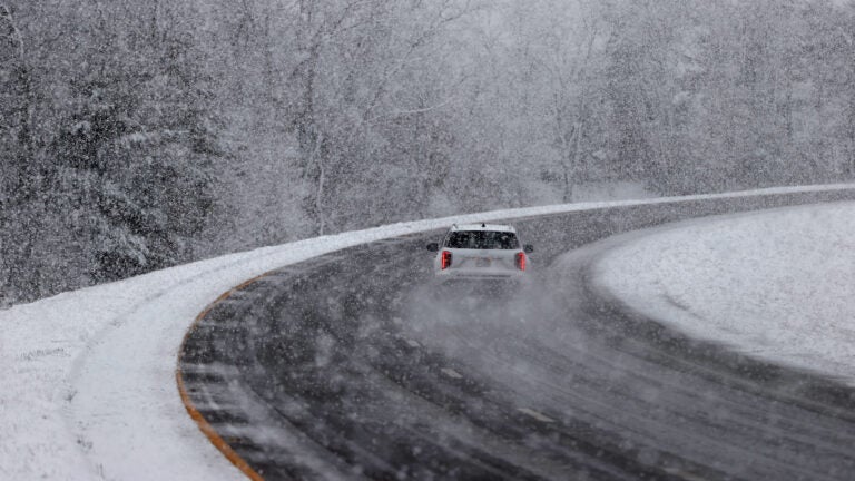
So what can we expect now? The biggest snow impacts are forecast for Rhode Island, southeastern Massachusetts, and parts of the Cape and Islands.
Those parts of southern New England may even see the foot of snow that Boston didn’t get, though it’s more likely that 6 to 8 inches of snow are recorded.
For Boston, Megnia admitted the forecast “has been tricky.”
“It’s going to be a very tight gradient of no snowfall to several inches of snowfall,” said Megnia, who added that the latest forecast shows 4 to 6 inches of plowable snow for some parts of metro Boston. “The closer you are to the coast, you’re probably going to see those numbers go down because of the warmer air temperatures from the ocean.”
As you get closer to the New Hampshire-Massachusetts border, snow estimates taper off, with most of the North Shore seeing likely no more than 2 to 3 inches of snow.
The snow also fell later Tuesday, and for most of eastern Massachusetts, that means it’s falling for a shorter duration. Megnia said snow is likely to fall through the early afternoon.
“Travel could be hazardous,” particularly for the South Shore. And low to moderate flooding is still a threat for those who live along the coast.
Stay up to date on all the latest news from Boston.com


Conversation
This discussion has ended. Please join elsewhere on Boston.com